Top Clients in This Industry
Brief Summary
Builterra was created to be more than just a Construction Contract Administration solution for Civil Engineers. It’s application in the Geotechnical and Materials Testing industry is field proven on design build projects in Canada since it’s early release in 2016. Starting as a replacement for notepads in Granular Density / Compaction testing was an easy implementation as a mobile field application and summary reporting tool for any geotechnical firm looking to go digital.
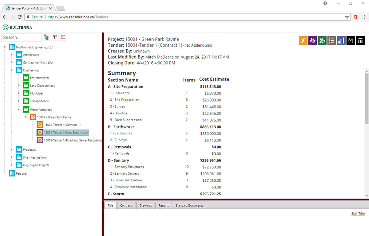
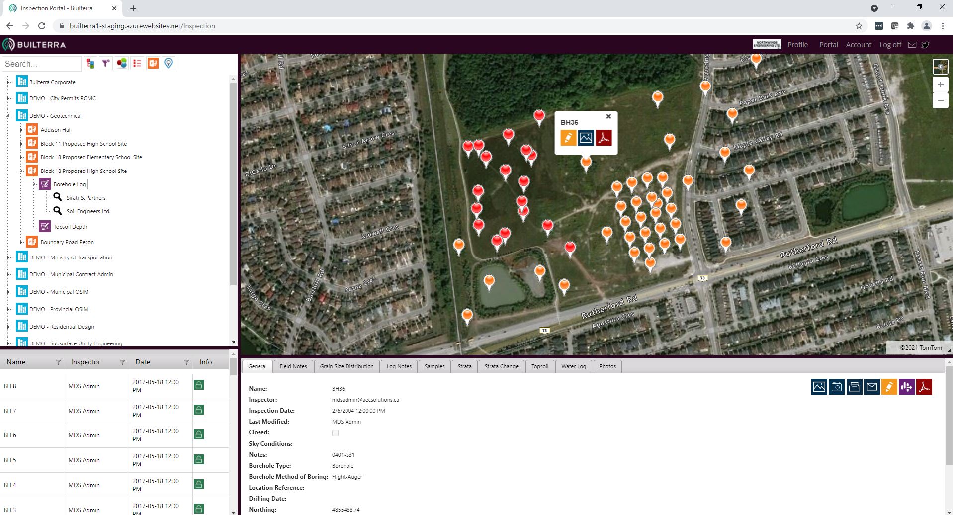
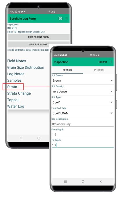
The geo-located data for testing in the field allows the field tech to easy perform simple data collection, photos and PDF edits used for test location markups. The expansion of the Builterra form configuration to do more complex Borehole Soil Investigations was a logical next step to take advantage of the data driven, looping data entry system employed for construction reporting. Having ability to build several sub-tables within the single borehole inspection record meant that users could freely add strata samples, penetration testing and water depth.
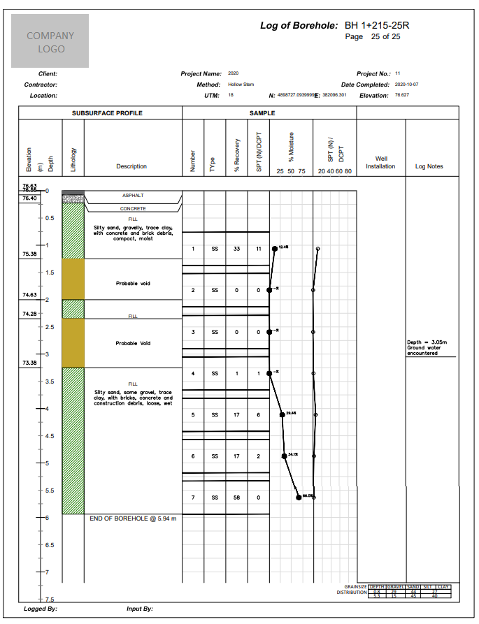
The Builterra Platform has also provided a seamless way to capture geotechnical data for projects like boreholes, test wells, compaction tests and more. Mobile data is collected and instantly available to the engineers & owners in real-time. Fully automated borehole logs, fence diagrams and plan n profile of boreholes in AutoCAD are now possible once data has been verified in the lab.
Digital Workflow

Case Example
Private Geotechnical Soil Investigation Firms
Private Materials Testing (Concrete, Granular, Pavement) firms
Public sector municipalities (Town, City, Country, Region) and transportation authorities doing road, transit, and highway projects

Top Features used in this Industry
Mapping Compatible
After Completing any geotechnical or materials testing inspection, data collected for the utility inspection is displayed in the Builterra Azure Map system in real-time.
Color themed pins for any inspection and it's lookup attributes is possible not unlike a GIS solution.
Using AutoCAD Extensions, utility inspection data can be brought into AutoCAD directly from the Builterra cloud for accurate drafting and design
Mobile Inspection
Same app, different data driven form entry options give the Geotechnical Professional a flexible method to collect data, photos and PDF document markups using one single solution.
Map view selection in the Builterra App show any pre-loaded utility or structure locations which means field staff can pick the inspection in the map and simply edit the attribute data, add photos and PDF markups
Reports can be approved and emailed directly from the Builterra App
Custom Reporting
Automate the complex report styles showing map location, project data, inspection data, photos with captions and even an automated cross section of the utility based on user data entry
Meta reporting provides the project managers with summary reports of detailed inspections in a tabular format.
Custom drafting extenstions can be provided for automation within the CAD environment


Geolocate, Collect and Report any Geotechnical and Material Testing Data
From Soil Investigations to Material Compaction, We have the Single Platform for all your project needs

