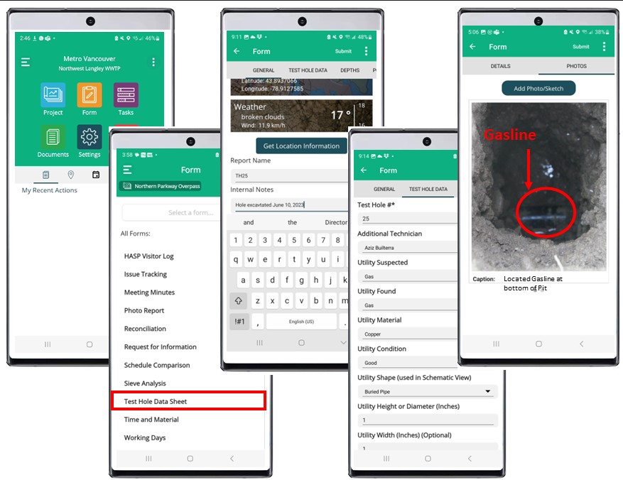
"While filling out the report in the field, what I like most about this mobile app is the location setting. If you are filling out multiple or numerous reports on one project, at each location you would hit the "Location" tab and would ping you in on a map at that exact location.”– Malo Tauaese, Kana Subsurface Engineering
Top Clients in This Industry
Brief Summary
Builterra was created to be more than just a Construction Contract Administration solution for Civil Engineers. It’s application in the Subsurface Utility Engineering industry is field proven on design build projects in Canada since it’s early release in 2015. Centralizing underground “Level A” utility inspection data with photos was a natural use case for the Builterra platform in the SUE industry.
As a “geocentric” inspection tool, non-GIS users can quickly configure any type of SUE data collection for field staff for data and photo collection. Builterra is the tool of choice if you are exposing utilities using Hydrovac excavation, doing measure downs, assessing utility types, condition and snapping photos. Same ease of use can be implemented for existing manhole structure (sewer and utility) pipe invert investigations and condition assessments using cell phones or tablets.
Inherently, the data collected is geolocated for inspection reporting, mapping and CAD drafting. Options include, export to GIS Shape file format and/or import of Builterra cloud data directly into AutoCAD. Very useful process for producing plans, sections, profiles and 3D models used in BIM processes.
For more accurate geolocation, Builterra is compatible with various GNSS Hardware for positioning accuracy down to the centimeter level.
Digital Workflow
Case Example
Wherever SUE Projects are required and undertaken – your Public sector municipality looking to improve utility as-built record keeping for use in any municipal project (sewer, water, road)
Design Build Infrastructure projects that require SUE investigations and collaboration with the consultant and owners. Most typically, Urban Transportation and Transit Infrastructure projects.
Annual Public Utility System Inspection Programs looking at Condition Verification on their existing networks. Basically, projects where thousands of excavations and inspections using multiple consultants to comply with State mandates to manage assets.
Top Features used in this Industry
Utility Mapping
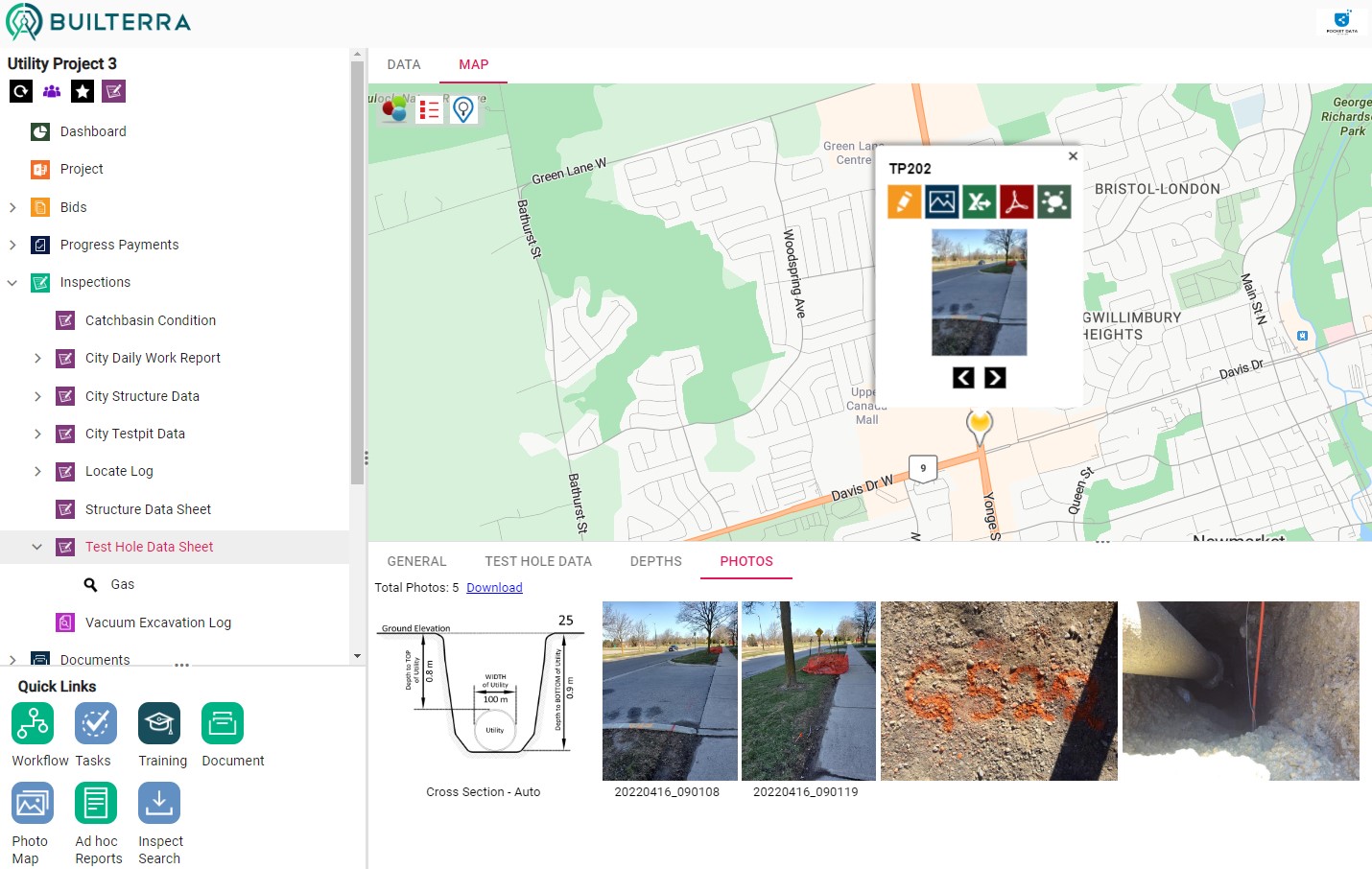
After completing Utility Location inspection, data collected for the utility inspection is displayed in the Builterra Azure Map system in real-time
Color themed pins for any inspection and it's lookup attributes is possible unlike a GIS solution
Using AutoCAD Extensions, utility inspection data can be brought into AutoCAD directly from the Builterra cloud for accurate drafting and design
Mobile Inspection
Same app, different data driven form entry options give the SUE professional a flexible method to collect data, photos and PDF document markups using one single solution
Map view selection in the Builterra app show any pre-loaded utility or structure locations which means field staff can pick the inspection in the map and simply edit the attribute data, add photos and PDF markups.
Reports can be approved and emailed directly from the Builterra app.
Custom Reporting
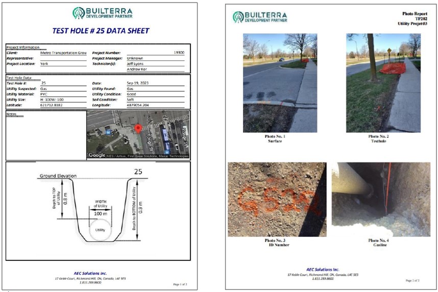
Automate the complex report styles showing map location, project data, inspection data, photos with captions and even an automated cross section of the utility based on user data entry.
Meta reporting provides the project managers with summary reports of detailed inspections in a tabular format.
Custom drafting extensions can be provided for automation within the CAD environment.
Standardize and Centralize all of your Subsurface Utility Data Collection and Reporting
Build your own Geocentric Utility Database for Public Owners, Civil Engineers and Utility Providers


