Geo Presentation feature highlights
The Builterra platform addresses key workflows in every civil engineering firm or government design and construction department. We bridge the technology gap between design and as-constructed asset management systems used by government. This gap can encompass up to four working groups at any private civil engineering office or public design & construction group.
Mobile Field Inspections
Web Portal Review and Reporting
Builterra Geo – Builterra Extension for AutoCAD
The Builterra Platform has provided other design and inspection groups within the same organization a powerful new platform to extend the data collection, image capture and reporting beyond Contract Administration workflows using the same web and mobile solutions.
About Builterra GEO
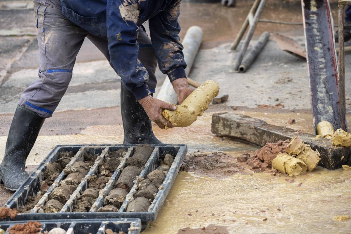
The Builterra Platform has also provided a seamless way to capture geotechnical data for projects like boreholes, test wells, compaction tests and more. Mobile data is collected and instantly available to the engineers & owners in real-time. Fully automated borehole logs, fence diagrams and plan n profile of boreholes in AutoCAD are now possible once data has been verified in the lab.
- Borehole Log from Mobile Data
- Borehole Fence Diagram from Mobile Data
- Borehole Plot to Plan from Mobile Data
- Borehole Projection to Profile View from Mobile Data
It’s all about Data!
Need a specific report or CAD plot? We can pretty much do anything with data collected and photos captured. We offer bespoke services to engineers looking to maximize their value in digital field inspection and reporting using cloud-based technology with the cost of ESRI GIS systems and integration.
Trimble Systems Integration
Mobile Field Inspection with Survey Precision
Trimble Catalyst may have been designed with surveying and GIS professionals in mind but its applications can reach beyond the obvious job roles when third party developers come into play.
Builterra is leveraging the flexibility of the Trimble Catalyst to provide more accurate data collection for civil engineers and contract administrators—saving time and money.
Huge Benefits for the NON-Surveyor
Builterra has recognized the benefits the Trimble Catalyst could bring to non-surveyors after its infrastructure clients began asking about 10cm to 1m precision when collecting data from the field using the Builterra mobile app.
For general contractors, engineers, architects and technologists, Global Navigation Satellite Systems (GNSS) were only available using dedicated hardware chips to sample numerous satellites for accurate positioning. Until now.
The Trimble Catalyst brings GNSS capabilities to the mobile phone—and paired with Builterra, represents the kind of technology convergence that the engineering and contract administration community has been waiting for.
ESRI Data Interoperability
All inspection data collected can be exported to ESRI SHP file format for GIS system integration. Complete inspection geo-location, meta-data, form attribute data can be exported seamlessly to the required format in Lat long spatial coordinate system.
Existing asset management data in SHP file format can be imported into Builterra Inspection list based on matching ESRI Attribute data using Lat Long Coordinate system. This is particularly useful when uploading exiting asset data for mobile field inspection editing and augmentation of existing asset data.
For project context, Builterra can overlay ESRI SHP files into the Bing world map for project review and inspection marker editing.
For the purposes of Document Management and File Sharing, Builterra has project specific cloud connectors that allow for external file storage and access by external consultants, contractors and project stakeholders.
When connected, Builterra automatically posts:
• Inspection Reports (Word, Excel or PDF)
• Inspection Photos (JPEG)
• Inspections List (Excel)
• Tender Bid Documents, Specification and Details (Word and PDF)
• Tender Cost Estimates and Schedule of Unit Prices (Excel)
• Progress Payment Certificates (Excel)
• Any other attached docs associated with the Project, Tender or Inspection (PDF)
Some of those external cloud document systems include:
• Microsoft Sharepoint
• Bentley Projectwise
• Autodesk BIM 360 Docs
• Oracle Aconex Docs
• Dropbox & Box.net
• Microsoft OneDrive
• Google Drive